Sendero Group Travel Blog
Follow Sendero travelers on their adventures using accessible GPS.Monday, September 07, 2015
Newport to Mulranny: Second Day of Hiking
Audio File of Mike narrating the second day of hiking.
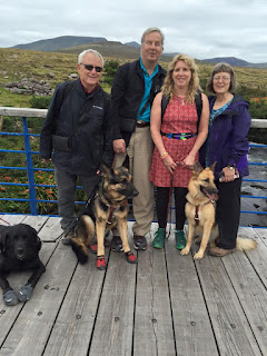
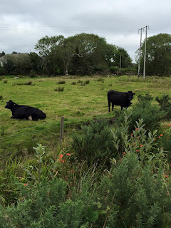
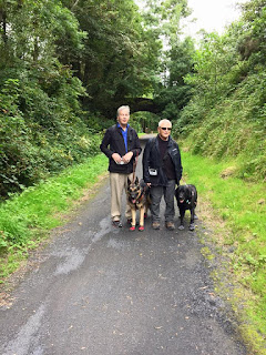
 Transcription: This is our second day of hiking. We have left Newport and we wound our way through town which was a little bit tricky with small sidewalks and city streets. Finally picked up the Greenway on the out skirts of town and it's paralleling the road, but at least it is off the road a little bit. We just passed some city or you know city really means a little village. We have passed the village of Knocknageeha. We are northwest, headed to our next stop which is Mulranny. Now this section of the path is just a typical kind of bike path and it is running along the end of 59, maybe 50 feet away from the road with plants and things in between. A lot of passers along the way. Passed a bunch of cows, a few barns, pretty infrequent foot traffic, bike traffic. We have seen a person on foot every 15 minutes and a biker maybe once an hour or a clump of bikers together. The dogs all have their booties on, so we have 12 dog booties to keep track of. Sue has to walk behind us because the shoes can come off easily and we won't know it and we will be missing one. The weather has continued to be dry. It's overcast, it's perfect. We thought we might be a little cold, but in fact we have to unzip not to get too hot.
  Noise of their footsteps.
Mike: Lets see how far we have to go?
BrailleNote: "6.35 kilometers, 1 o'clock Anchor House."
Mike: Anchor House is where we are headed and Newport 6.35 kilometers. How fast are we walking?
BrailleNote: 5.4 KMH
Mike: 5.4 Kilometers and hour, a little over 3 miles an hour. Of course that distance is as a crow flies and we might have to curve around a little bit, I am not sure.
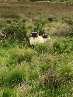
More crunching footsteps, a sheep lets out a baa!
We are walking through the fields here and almost to our final destination. On cue, another sheep bleats. Sounds like maybe Gena has some indigestion. Mike laughs. That would be the local sheep

Sunday, September 06, 2015
Day 2 of the Greenway Walk
 The rest of our 8 to 10 miles or so were uneventful. The
path was mostly paved without much elevation. The weather was kind to us and
the surroundings were very peaceful with the occasional bikers, walkers, sheep
and cows. Bob and I marked 20 or 30 points along the way.
Saturday, September 05, 2015
First travel tips from Dublin
Archives
August 1997 January 1998 August 1999 December 1999 January 2000 September 2004 October 2004 November 2004 December 2004 March 2005 May 2005 July 2005 August 2005 September 2005 November 2005 May 2006 June 2006 August 2006 September 2006 October 2006 November 2006 December 2006 February 2007 March 2007 April 2007 May 2007 July 2007 August 2007 September 2007 October 2007 November 2007 December 2007 January 2008 February 2008 March 2008 May 2008 June 2008 July 2008 August 2008 October 2008 January 2009 June 2009 July 2009 August 2009 September 2009 October 2009 November 2009 December 2009 January 2010 March 2010 April 2010 July 2010 October 2010 December 2010 February 2011 May 2011 July 2011 September 2011 October 2011 November 2011 January 2012 February 2012 March 2012 April 2012 May 2012 July 2012 August 2012 October 2012 November 2012 December 2012 January 2013 March 2013 June 2013 July 2013 August 2013 September 2013 October 2013 November 2013 December 2013 January 2014 March 2014 April 2014 August 2014 September 2014 October 2014 November 2014 December 2014 February 2015 July 2015 August 2015 September 2015 November 2015 December 2015 January 2016 January 2017 September 2018 November 2018


